About us
Mapping the world.Elevating Possibilities
At Aerochart Mapping, we specialize in delivering precise, reliable, and innovative solutions in land surveying and civil aviation consultancy. With over 13 years of industry experience, we have built a strong reputation for accuracy, efficiency, and professional excellence.
Our expertise spans across land surveys, mapping, geospatial analysis, and aviation-related technical services, enabling us to support infrastructure, construction, and aviation projects with confidence. We combine advanced technology with practical field knowledge to ensure every project meets the highest standards of quality and compliance.
At Aerochart Mapping, we believe that precision is the foundation of progress. Whether it’s a small-scale survey or a large aviation project, our commitment remains the same — delivering dependable data, strategic insights, and end-to-end solutions.
Driven by integrity, innovation, and client satisfaction, we aim to become a trusted partner for developers, government bodies, and aviation stakeholders.
Our service
At Aerochart Mapping, we provide end-to-end solutions in land surveying, mapping, and civil aviation consultancy. With over 13+ years of experience, we combine field expertise with advanced technology to deliver precise, reliable, and actionable results.
1. Land Surveying Services
We offer accurate and comprehensive land surveying solutions for all types of projects:
- Topographical Surveys
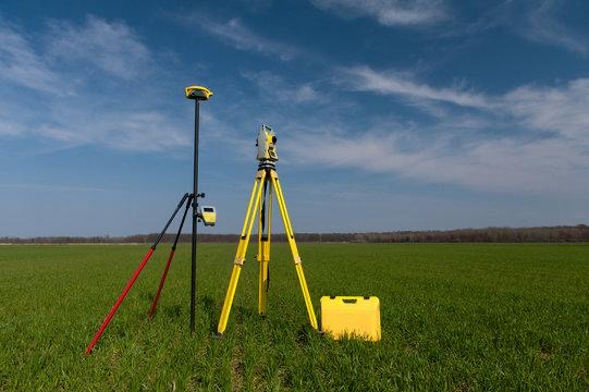
- DGPS Survey
- OLS Survey
- Boundary & Demarcation Surveys
- Layout & Plotting Surveys
- Construction & Infrastructure Surveys
- Road, Highway & Utility Surveys
Our team ensures high-precision data collection using modern instruments, helping clients make informed decisions with confidence.
2. Mapping & Geospatial Solutions

We transform raw data into meaningful insights through advanced mapping techniques:
- GIS Mapping & Data Analysis
- Digital Mapping & CAD Drafting
- Contour Mapping
- Drone Survey Mapping (UAV-based)
- Satellite Image Analysis
Our geospatial solutions enable better planning, visualization, and execution of projects.
3. Civil Aviation Consultancy

We provide specialized consultancy services for aviation-related projects:
- Height Clearance & Obstacle Limitation Surface (OLS) Analysis
- Aviation NOC Assistance
- Airport Vicinity Survey & Compliance
- Flight Path & Safety Assessment
- Regulatory Coordination & Documentation
We ensure all projects comply with aviation safety norms and regulatory requirements.
4. Project Planning & Execution Support

From concept to completion, we assist clients in seamless project execution:
- Site Analysis & Feasibility Studies
- Survey Data Interpretation
- Technical Reports & Documentation
- Coordination with Architects & Engineers
Our approach ensures efficient planning and smooth project delivery.
5.Specialized Survey Solutions

We also offer customized services tailored to specific project needs:
- Hydrographic Surveys
- Industrial & Large-Scale Land Surveys
- As-Built Surveys
- Monitoring & Control Surveys
A few things we’re great at
High-precision surveys and mapping solutions that support smarter planning and safer aviation.

🚀 Precision You Can Trust
Every project is handled with high accuracy and attention to detail.

🌍 Smart Mapping Solutions
We transform complex data into clear and usable insights.

⏱️ On-Time Execution
We value your time and deliver projects without delays.
Our Vision
Our vision is to become a leading and trusted name in land surveying and civil aviation consultancy, recognized for excellence, innovation, and precision.
We aim to set new benchmarks in the industry by integrating advanced mapping technologies, modern surveying techniques, and aviation expertise, contributing to the growth of infrastructure and aviation sectors across India and beyond.
Why Choose Us
✔ 13+ Years of Proven Experience
✔ High Accuracy & Advanced Technology
✔ Aviation Expertise & Compliance Knowledge
✔ Professional Team & Timely Delivery
✔ End-to-End Solutions Under One Roof
Sector we work with
✈️ Airport Authorities
🏗️ Infrastructure & Construction Companies
🏢 Government & Public Sector
🌍 Real Estate Developers
📡 Engineering & Survey Firms
What are you waiting for?
Ready to take the next step? Let’s bring your vision to life! Explore our services and get in touch today for a consultation. Together, we’ll make it happen.
Our team
Our team is composed of experienced survey engineers, DGPS specialists, and aviation consultants dedicated to delivering accurate, efficient, and high-quality solutions.
We combine technical expertise with practical field experience to ensure every project meets the highest standards.
Our work in numbers
employees
10
happy clients
+50k
years of experience
+10
Explore Our Blog
Hello world!
Welcome to WordPress. This is your first post. Edit[…]